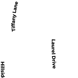
64 LAUREL DR
Owner Information
SHERMAN GLENN H
64 LAUREL DR
HUDSON, MA 01749


Property Details
64 LAUREL DR is classified as a Single Family Residential (Colonial).
The primary structure on this property was built in 1998. There are 3,696ft2 of built area within this property. There is 2,256ft2 of residential/living space within this property. This property is listed as having 6 rooms.
64 LAUREL DR is valued at $455,400. The land is valued at $161,700 and the structures are valued at $289,600. There is an additional valuation of $4,100 on this property.
This property is in Zone SA8. Confirm with local Zoning Board authorities to ensure there are no overlays or other easements on this property.
The most recent deed for 64 LAUREL DR is recorded at the local registrar in Book 29366, Page 94. 64 LAUREL DR was last sold on Friday, November 13, 1998 for $247,150.
Assessment data from fiscal year 2021.
Flood Data
According to the FEMA National Flood Hazard Layer, this property does not appear to be in a flood zone. It may also be in an area not yet reviewed. Nonetheless, confirm this information prior to taking any action.
To view the flood hazards around this property, create a FEMA "Firmette" Map of the area around 64 LAUREL DR.
Broadband Internet Providers
| Provider | Type | Bandwidth (mbps) | |
|---|---|---|---|
| HughesNet | Satellite | 25 | 3 |
| GCI Communication Corp. | Satellite | 0 | 0 |
| VSAT Systems, LLC. | Satellite | 2 | 1 |
| Comcast | Cable | 1000 | 35 |
| Verizon New England Inc. | Fiber | 940 | 880 |
| Viasat Inc | Satellite | 100 | 3 |
| Verizon New England Inc. | DSL | 7 | 0 |
Broadband service provider data from December 2020.
Adjacent Properties
- 14 RIDGE RD
Single Family Residential owned by KYLIE GRANT - 66 LAUREL DR
Single Family Residential owned by DWORETSKY LARRY NORMAN - 16 RIDGE RD
Single Family Residential owned by HARRINGTON CHRISTOPHER J - 62 LAUREL DR
Single Family Residential owned by ROAN JAMES D - LINCOLN ST
Vacant, Conservation (Municipal or County) owned by TOWN OF HUDSON TOWN HALL